Safecoast
Safecoast
Coastal Hazard Intelligence Platform
Editorial Case Review
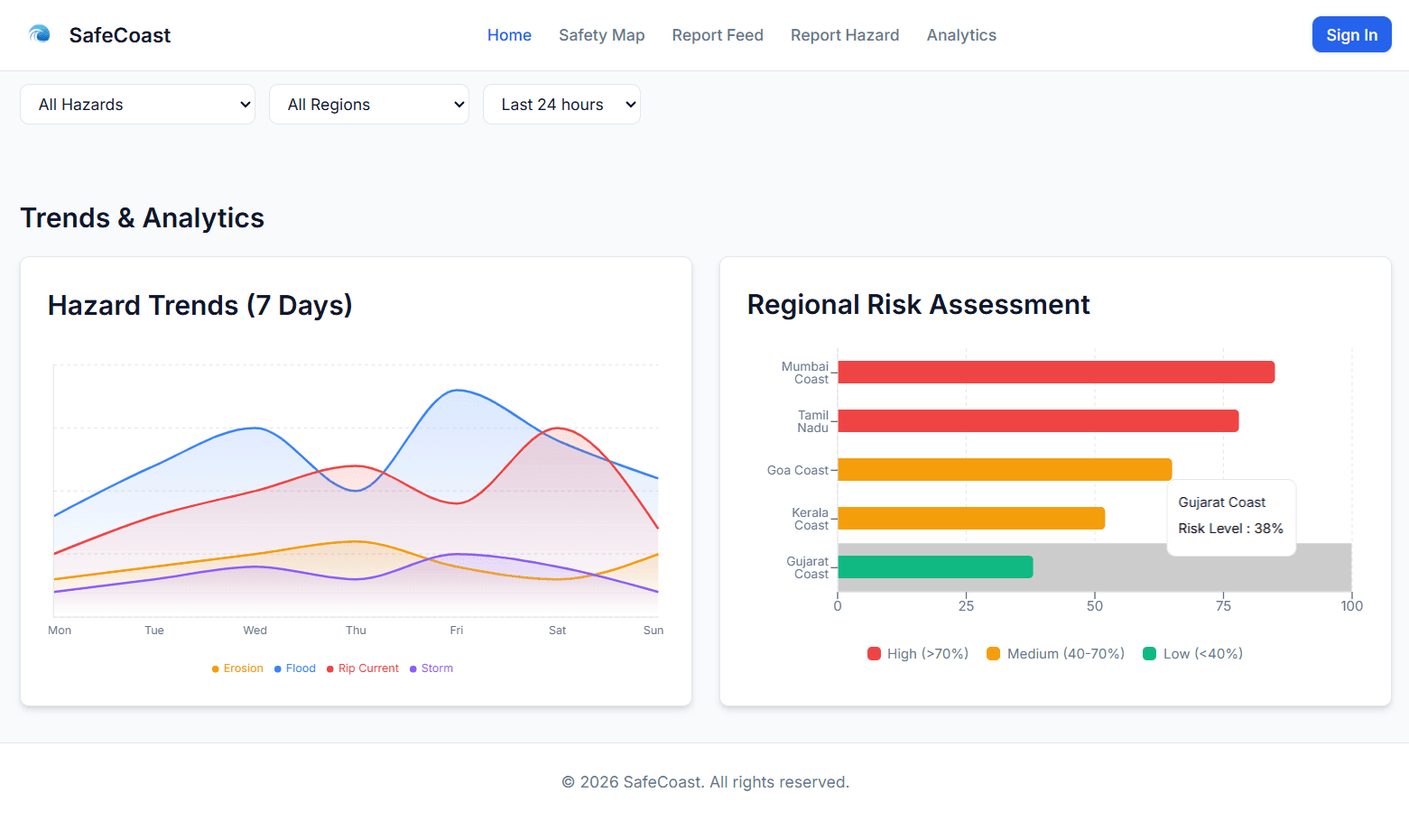
Safecoast is an environmental dashboard application created to help rescue organizations and researchers monitor coastal environments. The app integrates data streams from atmospheric, tidal, and marine telemetry sources to model potential flooding, erosion, and storm surges. With a clean map-driven dashboard interface, users can examine historical hazards and configure threshold alerts.
Core Capabilities
Real-time hazard monitoring and alert system
Interactive data visualization dashboard
Predictive analysis for coastal risk assessment
Engineering Case Study
Ingesting, normalizing, and rendering complex GIS coordinates and meteorological weather JSON streams without introducing heavy re-renders in the browser viewport.
Developed an API aggregation server in Node.js that cleans and maps geo-coordinates. The frontend uses highly optimized SVG mappings and debounced state layers to handle real-time spatial analytics updates cleanly.
Key Facts
Built With
Product Performance
Interface Gallery